Product Item Map #
Introduction #
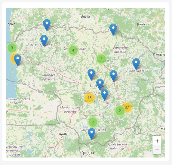
The Product Item Map is a geospatial visualization component that plots product template items as interactive markers on an OpenStreetMap-based map. Each item is positioned using configured latitude and longitude attributes, and nearby markers are automatically clustered for readability when zoomed out. Clicking a marker opens a popup with the item’s attribute details, making it ideal for visualizing the spatial distribution of assets, sites, or devices.
Features #
- Interactive map powered by OpenStreetMap tiles
- Automatic marker clustering for dense areas
- Configurable latitude and longitude source attributes
- Optional filter expression to limit displayed items
- Popups showing product template attributes, with support for hidden columns
- Automatic view framing: fits to data bounds, zooms to a single item, or falls back to a default region when no data is available
- Adjustable component height
- Scroll-wheel zoom and dedicated zoom control
Use Cases #
- Mapping the locations of metering points, sensors, or IoT devices
- Visualizing the geographic distribution of customer sites or facilities
- Monitoring spatially distributed assets across a region
- Identifying clusters of items in specific areas
- Inspecting per-site attribute data directly from a dashboard
Example #